Servicios Topográficos

Ofrecemos levantamientos precisos y soluciones innovadoras en topografía y geodesia en Chile.

Levantamientos Topográficos
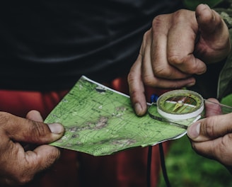
Hands are holding a topographic map and a compass. One hand is pointing at a specific location on the map, indicating navigation or orientation. The map is detailed with green shades, representing terrain or elevation.

Realizamos levantamientos de alta precisión para proyectos de infraestructura y estudios geodésicos.

Majestic snow-capped mountains rise sharply under a partly cloudy sky with a natural foreground of grassy terrain. A group of guanacos is seen grazing peacefully amidst the rugged landscape, highlighting the serene and untouched wilderness.
An aerial view of a vast landscape featuring a patchwork of fields, with variations in terrain, showing valleys and rivers. The land appears to be a mix of agricultural and natural areas, with roads and small buildings scattered throughout. The topography includes some elevated regions and woodland areas.
Tecnología Avanzada

Utilizamos herramientas modernas para garantizar resultados precisos y eficientes en cada proyecto.

Consultoría en topografía y monitoreo de riesgos naturales para asegurar la seguridad de sus proyectos.

Consultoría Especializada

Expertos en topografía y geodesia

En Carvajal topografía, ofrecemos servicios de topografía de alta precisión, utilizando tecnología avanzada para garantizar resultados confiables y eficientes en proyectos de infraestructura y estudios geodésicos en Chile.

A tripod-mounted surveying instrument is prominently placed in the foreground, with a large construction site visible in the background. Tall cranes and unfinished buildings indicate ongoing construction work, set against a clear blue sky.

150+

15

Clientes satisfechos

Calidad garantizada

gray computer monitor

Contáctanos

Estamos aquí para ayudarte con tus necesidades topográficas.